Region
East of England
The East of England is a landscape shaped by sea, soil and centuries of movement. From the ancient fens and fertile farmland of Cambridgeshire and the wool towns of Suffolk and Essex to the Norfolk coast and the great ports of the east, its villages, towns and landscapes carry traces of Roman Britain, Anglo-Saxon kingdoms, Vikings, medieval merchants, Georgian estates and modern innovation. It is a region where history is rarely far from the path beneath your feet.
2 towns in service
What’s on in the East of England
What’s On
Coming up2026
- Ipswich is launching soon
Towns and cities in the East of England
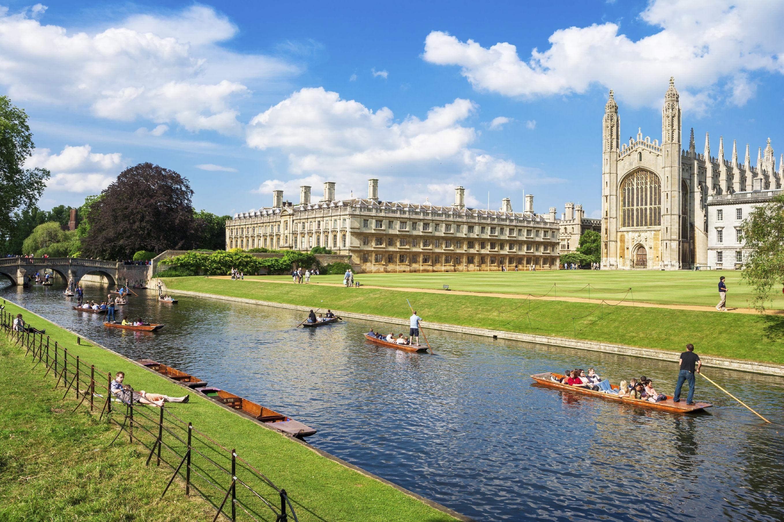 CambridgeshireCambridgeA city of colleges, punts, bicycles, and the enduring belief that every intellectual debate is improved by relocating it to a pub.79 pubs1 networkPub Crawl
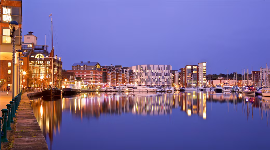 SuffolkIpswichIpswich, where history flows as freely as the ale, and every platform tells a story.35 pubs1 networkArt TrailPub Crawl
About the East of England
The East of England: A History Written into the Landscape
The East of England is one of the most historically layered parts of Britain. Today the region encompasses Bedfordshire, Cambridgeshire, Essex, Hertfordshire, Norfolk and Suffolk, stretching from the northern edge of London to the Wash and from the Hertfordshire countryside to the North Sea. Within that broad area are several distinct landscapes: the agricultural heartlands of East Anglia, the low-lying Fens, the chalk hills and wooded countryside of the south and west, and a long, deeply indented coastline.
Its history is inseparable from those landscapes. Rivers, estuaries, marshes, fertile soils and access to the North Sea have repeatedly shaped where people settled, how they made a living and how they connected with the wider world. Archaeological research treats the eastern counties as a particularly rich historical landscape, with evidence extending from the Palaeolithic through the Roman, Anglo-Saxon, medieval and modern periods.
The Earliest People
The story begins long before the counties and towns we recognise today. During prehistoric periods, much of eastern Britain looked radically different from the modern landscape. Sea levels rose and fell, rivers changed course and large areas of what are now the Fens and coastal lowlands were repeatedly transformed.
The East of England contains some of Britain's most important prehistoric archaeology. At Grime's Graves in Norfolk, people mined flint more than 4,000 years ago, producing material that was traded over considerable distances. Across the region, Neolithic monuments, Bronze Age burial sites, ancient trackways and extensive field systems reveal increasingly organised farming communities.
The landscape was already being shaped by people on a large scale. Fields were divided, woodland cleared, livestock raised and settlements established. Some of the boundaries visible in today's countryside have their origins in these very old patterns of land use.
The Iron Age and the Coming of Rome
By the Iron Age, eastern Britain was home to sophisticated societies organised around tribal territories, farming communities and defended settlements. The region occupied a strategically important position facing the North Sea and the European mainland.
The Roman invasion of AD 43 brought eastern Britain directly into the Roman world. Roman roads, settlements, villas, farms and military installations spread across the region. Colchester became one of the most important Roman settlements in Britain and was established as a major centre of Roman administration. Cambridge, known to the Romans as Duroliponte, developed around an important crossing of the River Cam, while other settlements and roads connected the agricultural interior with ports and markets.
Roman influence was not confined to towns. The countryside was reorganised around estates, farms and new patterns of production. Goods, people and ideas moved along roads and waterways, connecting the region to the rest of Britain and ultimately to the wider Roman Empire.
After almost four centuries of Roman rule, that system began to break apart in the early fifth century. Roman administration disappeared, but the landscape and infrastructure it had created continued to influence settlement for centuries.
The Kingdom of the East Angles
The centuries following the end of Roman rule saw the emergence of new kingdoms and identities. Among them was the Kingdom of East Anglia, broadly corresponding to modern Norfolk and Suffolk.
Angles, Saxons and other peoples from across the North Sea settled in eastern Britain, becoming part of the transformation that eventually produced Anglo-Saxon England. The precise nature of this transformation remains debated, but archaeology reveals a society that developed its own distinctive culture, trade networks, political structures and artistic traditions.
One of the greatest archaeological discoveries of the period lies at Sutton Hoo near Woodbridge in Suffolk. The famous ship burial, probably dating to the early seventh century, contained extraordinary weapons, jewellery and other objects demonstrating the wealth and international connections of the East Anglian elite. Objects associated with the burial show connections extending across the North Sea and into continental Europe and Scandinavia.
Christianity also transformed the region. Churches, monasteries and bishoprics became centres of learning, administration and power. The conversion of Anglo-Saxon kingdoms brought eastern England into the wider Christian world while leaving a remarkable legacy of churches, sculpture and manuscripts.
Vikings and the North Sea World
The East of England was particularly exposed to Viking activity because of its position on the North Sea.
In AD 869, the Viking Great Army reached East Anglia and defeated King Edmund, who subsequently became one of England's most celebrated saints. Thetford became an important Viking centre, while much of eastern England was drawn into the Scandinavian political and commercial world.
This was not simply an age of raiding. Scandinavian settlement brought new people, languages, customs and trading connections. East Anglia became part of a North Sea network linking England with Scandinavia and continental Europe.
By the tenth century, the English kingdom was being consolidated. East Anglia was incorporated into the emerging Kingdom of England, although Scandinavian influence remained deeply embedded in the region's landscape, place names and culture.
The Norman Transformation
The Norman Conquest of 1066 brought another dramatic change.
William the Conqueror and his successors reorganised land ownership and political power throughout England. Castles were constructed to control strategic locations, while monasteries and churches were rebuilt on an enormous scale.
Norwich became one of medieval England's great cities. Its castle and cathedral still dominate the city today. Ely Cathedral emerged from the extraordinary fenland landscape as one of medieval England's most remarkable buildings, while castles such as Framlingham, Castle Rising and Castle Acre reflected the military and political importance of the region.
The Normans also formalised landholding and taxation through the Domesday survey of 1086. Much of the East of England was highly productive agricultural country, and its wealth would become one of the foundations of the region's medieval prosperity.
Wool, Trade and the Medieval Towns
During the later Middle Ages, the East of England became one of the wealthiest parts of England.
Its fertile agricultural land produced grain and livestock, while East Anglia became particularly important in the wool trade. Wool from the region fed the growing cloth industries of England and Europe, creating fortunes for merchants and landowners.
The wealth of this period can still be seen in places such as Lavenham, Long Melford, Dedham, Saffron Walden and many other historic towns and villages. Timber-framed houses, guildhalls, churches and merchant buildings survive as physical reminders of an economy that connected seemingly remote communities to international markets.
The great medieval churches of East Anglia are another legacy of this prosperity. Villages that appear modest today could once support remarkably large churches because local communities and wealthy merchants invested heavily in religious buildings.
The Fens: A Landscape Transformed
Few landscapes illustrate the relationship between people and the environment better than the Fens.
For centuries, the low-lying wetlands of Cambridgeshire, Norfolk and Lincolnshire were a complex mixture of open water, reed beds, marshes, islands and seasonally flooded land. They provided fish, wildfowl, reeds, peat and grazing, while also acting as a natural barrier.
From the medieval period onwards, attempts were made to drain and reclaim parts of the Fens. These efforts accelerated dramatically from the seventeenth century, when Dutch engineers and English landowners undertook major drainage schemes.
The transformation was immense. Wetland became farmland, new drainage channels were constructed and settlements were connected by an engineered landscape of rivers, drains, banks and pumps.
The modern Fens therefore represent not untouched countryside but one of Britain's greatest examples of landscape engineering.
Reformation, Rebellion and Changing Power
The sixteenth century brought religious and political upheaval.
The English Reformation under Henry VIII led to the dissolution of the monasteries and the destruction or repurposing of many religious buildings. The effects were particularly visible in a region rich in monasteries and ecclesiastical wealth.
East Anglia also became associated with religious dissent and reforming ideas. Cambridge developed into a major centre of intellectual and religious debate, while communities across the region were affected by the upheavals of the Tudor and Stuart periods.
The region's prosperity continued to rest heavily on agriculture, trade and manufacturing. At the same time, its proximity to London increasingly connected its southern counties to the capital.
Agriculture and the Agricultural Revolution
From the seventeenth into the nineteenth centuries, agriculture changed profoundly.
East Anglia became one of the principal centres of Britain's agricultural revolution. New methods of crop rotation, drainage, selective breeding and land management increased productivity. Historic research identifies East Anglia, and Norfolk in particular, as being at the forefront of these changes during the eighteenth century.
The countryside that visitors see today is therefore partly the product of centuries of agricultural experimentation.
Large estates, farmhouses, barns, hedgerows, field boundaries and planned landscapes all record this transformation. In many places, the distinction between "natural" countryside and human-created landscape is almost impossible to draw.
Industry, the Coast and the Rise of the Modern Region
The East of England did not industrialise in exactly the same way as northern England. Agriculture remained extraordinarily important, but the region developed distinctive industries of its own.
Ports and coastal towns became centres of fishing, shipbuilding, trade and maritime activity. Great Yarmouth, Lowestoft, Harwich, Ipswich and other ports connected the region to the North Sea and beyond.
Norwich developed important textile and manufacturing industries. Cambridge became increasingly associated with scholarship and science. Essex and Hertfordshire, meanwhile, were increasingly influenced by their proximity to London.
The coming of the railway in the nineteenth century transformed the region again. Towns that had previously depended on roads, rivers or coastal shipping became connected to national markets. Coastal resorts expanded as railway travel brought visitors from London and elsewhere.
The Victorian Landscape
The Victorian period left an enormous architectural and social imprint.
Railways, stations, schools, town halls, churches, industrial buildings and new housing reshaped towns and cities. Agricultural villages acquired new services and connections, while expanding urban centres developed distinctive Victorian streetscapes.
The period also saw the growth of the great country houses and designed landscapes that remain among the region's best-known attractions. Estates such as Audley End, Hatfield and others reflect centuries of changing ideas about wealth, landscape, architecture and status.
At the same time, the region's agricultural economy remained fundamental. The contrast between wealthy estates, prosperous market towns and agricultural labour communities became an important part of the social history of eastern England.
War on the Eastern Frontier
The East of England's geography made it strategically important during both World Wars.
Its coastline faced directly towards continental Europe, while its relatively flat terrain made the region ideal for military airfields. During the Second World War, RAF stations and airfields appeared across Norfolk, Suffolk, Cambridgeshire and Essex.
The region became one of the principal bases for Allied bombing operations against occupied Europe. American and British aircrews passed through dozens of airfields, leaving a substantial but sometimes overlooked wartime heritage across the countryside.
Coastal defences, pillboxes, radar stations, airfields and military installations remain scattered throughout the landscape.
New Towns and the Modern East
After the Second World War, the relationship between the East of England and London changed dramatically.
The region became an important destination for London's expanding population. Stevenage, Harlow and other planned communities were developed as New Towns, deliberately designed to provide new homes, employment and infrastructure away from the capital. Stevenage was designated Britain's first post-war New Town in 1946.
Earlier, Letchworth Garden City had pioneered an entirely different vision of urban development. Founded at the beginning of the twentieth century, it became the world's first Garden City, combining housing, employment and green space in a planned community.
These experiments helped shape the modern landscape of Hertfordshire, Essex and the areas around Cambridge.
Cambridge and the Knowledge Economy
The modern East of England is also a region of science, technology and innovation.
Cambridge University has been at the centre of intellectual life for centuries, but the city increasingly became a major centre for scientific research and technology during the twentieth century. The development of the Cambridge science and technology cluster created a new economic identity for the region, linking ancient university traditions with modern research, engineering and entrepreneurship.
This sits alongside long-established agricultural, maritime and manufacturing economies, creating one of the defining characteristics of the modern East of England: old and new industries existing within a remarkably historic landscape.
A Landscape of Layers
Perhaps the most distinctive feature of the East of England is that its history remains unusually visible.
A Roman road may become an Anglo-Saxon boundary, a medieval field system may survive beneath modern agriculture, a wool merchant's house may stand beside a Georgian building, and a former military airfield may sit only a few miles from a prehistoric monument.
Historic England's research describes the region as possessing an exceptionally rich archaeological resource, while its surviving buildings, landscapes and archaeological sites provide evidence for thousands of years of changing settlement and land use.
The result is a region that rewards exploration. Its history is not concentrated in a handful of famous monuments. It is distributed through its villages, market towns, churches, coastlines, waterways, fields, paths and streets.
That makes the East of England particularly well suited to discovery on foot: the landscape itself is the history book.